
Best Places to hike in Las Vegas, Nevada
Hiking in Las Vegas can be a great way to explore the vast desert landscape and get some fresh air. With its stunning sunsets, rugged terrain, and diverse wildlife, it is no wonder that hiking has become one of the most popular outdoor activities in Las Vegas. Whether you’re looking for an easy walk or a challenging climb up Red Rock Canyon or Mount Charleston, there are plenty of trails available to suit all levels of hikers. No matter what kind of experience you hope to have while hiking in Las Vegas, there is sure to be something suited just right for your skillset and physical abilities! So grab your gear and hit the trail – adventure awaits!
Best 13 Hiking Trails Near Las Vegas
Below are some of the best hiking trails near Las Vegas where you’ll see limestone caves, ancient petroglyphs, a waterfall, dreamy views of the desert, and more.
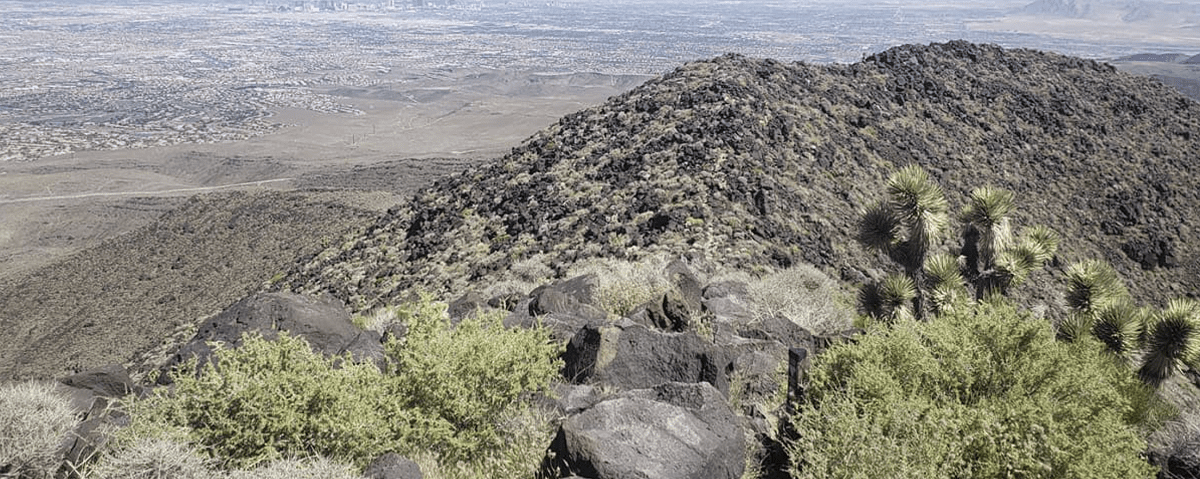
1. Bowl of Fire
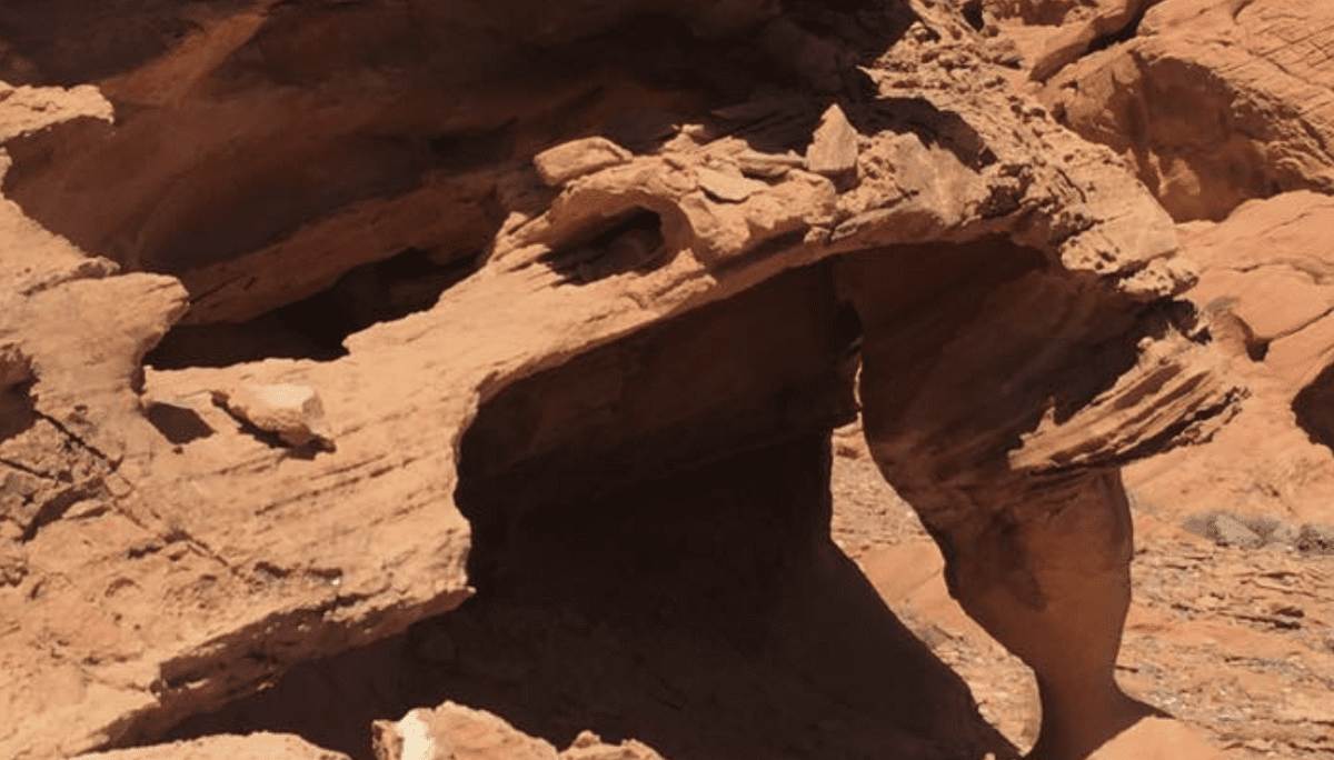
The Bowl of Fire Trail is a 4.5 mile loop trail located in Red Rock Canyon National Conservation Area, near Las Vegas, Nevada. The trail is known for its spectacular views of the red sandstone canyon walls and surrounding desert landscape. This popular hiking route takes visitors through three distinct geological formations: the Keystone Thrust fault line, Aztec Sandstone cliffs, and Jurassic-age limestone outcroppings.
Along the way hikers will find an array of wildlife including bighorn sheep, mule deer, jackrabbits, lizards and birds such as roadrunners and hummingbirds. At the beginning of the hike you’ll pass by a large bowl-shaped alcove carved into the sandstone rock
formation which gives this hike its name – “Bowl Of Fire”. From here you’ll traverse up switchbacks to reach higher elevations where you can take in stunning vistas across all directions – especially at sunset when it casts an orange glow on everything below! You may also spot some ancient petroglyphs etched onto rocks along your journey too which add another element to this already incredible experience.
If you want to explore even more then there are additional trails that branch off from Bowl Of Fire allowing you to extend your exploration further than just one single loop route – so make sure to bring plenty of water with you if doing any extended hikes! There are also
opportunities for rock climbing or bouldering at various points throughout as well – so be prepared if these activities interest you!
Elevation: 400 feet | Distance: 3.7 miles | Difficulty: Moderate
2. Historic Railroad Trail
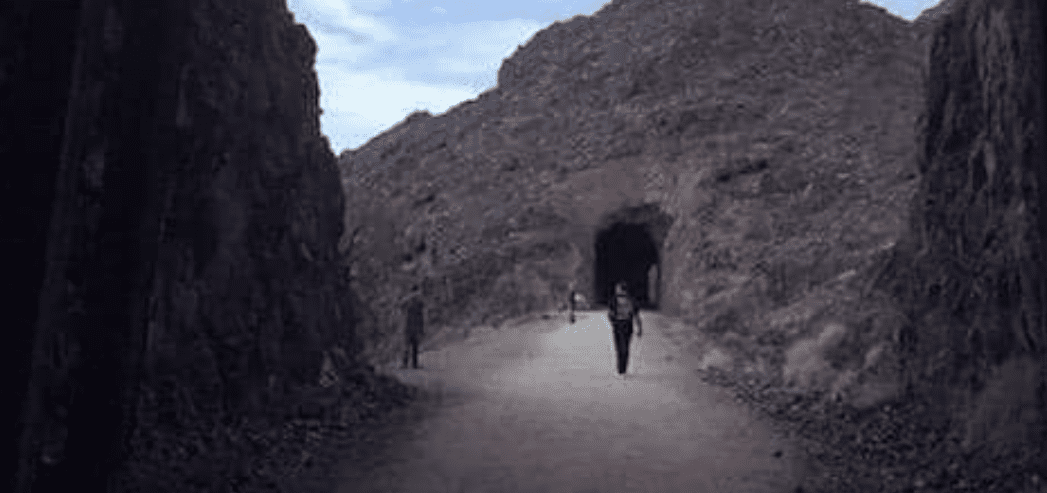
The Historic Railroad Trail in Las Vegas is a 4.5 mile trail that follows the abandoned Union Pacific railroad line from downtown to Henderson. This scenic walking, biking and horseback riding path offers breathtaking views of the desert valley, mountain ranges, and city skyline as it winds its way through some of Las Vegas’ most picturesque landscapes.
The trail passes by several historic sites including the former site of an early 20th century railroad station, the Boulder City Depot and Museum, Lake Mead National Recreation Area Visitor Center, Hoover Dam Bypass Bridge overlooks and more. The Historic Railroad Trail also connects with other trails like The River Mountains Loop Trail which circles around Lake Mead National Recreation Area while providing stunning views of Lake Mead itself along with other nearby landmarks such as Hoover Dam.
Additionally this trail provides access to many parks including Bootleg Canyon Park which boasts spectacular rock formations for biking or hiking; Floyd Lamb State Park which features open meadows for wildlife viewing; and Sunset Park where visitors can enjoy picnic areas, playgrounds and sports courts among other amenities. Given its easy accessibility from downtown Las Vegas along with its natural beauty this area has become a popular destination for locals looking for outdoor recreation opportunities as well as tourists seeking an alternative way to experience all that Sin City has to offer beyond casinos and nightlife.
Elevation: 11 feet | Distance: 7.5 miles | Difficulty: Easy
3. Lone Mountain Loop Trail
The Lone Mountain Loop Trail is a 4.5-mile loop trail that takes hikers through the scenic Red Rock Canyon National Conservation Area near Las Vegas, Nevada. The hike offers stunning views of the surrounding desert landscape and wildlife, as well as unique rock formations and canyons. Along the way, visitors will find a variety of flora and fauna, including Joshua Trees, cacti, lizards and birds.
The trailhead for the Lone Mountain Loop Trail begins at an elevation of about 3200 feet above sea level. From here hikers will climb to an elevation of approximately 3800 feet before descending back down to the starting point again. This moderate difficulty trail has several steep sections which require some scrambling over loose rocks and boulders in certain areas; however it’s still relatively easy for most experienced hikers with good balance and agility.
Along this beautiful journey you’ll have plenty of opportunities to take in incredible views from various vantage points along the path – especially if you make it up to Mescalito Peak (elevation 4100 ft). Here you’ll be rewarded with panoramic vistas that stretch out across all directions from atop this majestic peak! In addition to its natural beauty, there are also numerous historical sites located along this route such as Tecopa Pueblo Ruins which were built by ancestral native Americans who once lived in this area thousands of years ago.
Distance: 3.2 miles | Difficulty: Easy
4. Fire Wave Trail
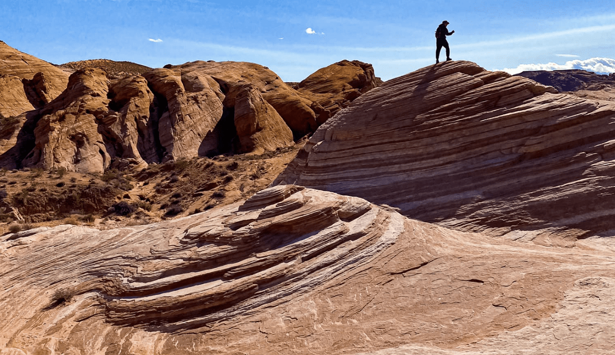
The Fire Wave Trail in Las Vegas is a popular hiking spot located in the Valley of Fire State Park. This trail offers stunning views and an incredible experience for avid hikers. The Fire Wave Trail is one of the most beautiful trails in Nevada, boasting vibrant sandstone formations that are illuminated by the sun’s rays.
This moderate two-mile loop trail takes about 2 hours to complete and provides spectacular views of red rocks, canyons, petrified logs, and other geological wonders along its path. As you make your way through this area, you will come across some interesting rock formations such as “the fire wave” itself—a series of white and pinkish swirls on the sandy surface resembling waves from an ocean shoreline—as well as “the beehives”—massive sandstone boulders shaped like beehives due to their unique erosion patterns over time.
Hiking at Fire Wave Trail can be dangerous if visitors fail to take proper precautions; therefore it is important to bring plenty of water and wear sturdy shoes with good traction when exploring this site. Additionally, visitors should also stick together while on this hike since there are no marked trails or signs throughout the area making it easy to get lost among all the rocks! Finally, remember that pets aren’t allowed here so leave them at home before venturing out into this amazing desert oasis!
Elevation: 175 feet | Distance: 1.5 miles | Difficulty: Moderate
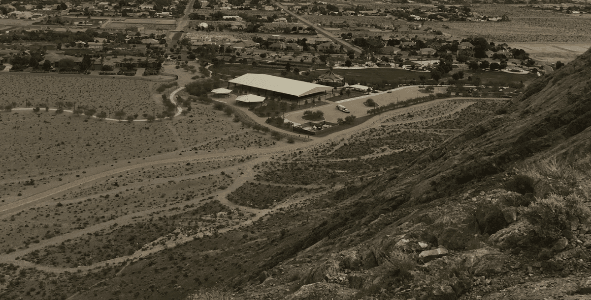
5. Black Mountain Trail
The Black Mountain Trail is a popular hiking trail located in Las Vegas, Nevada. This 3.5-mile loop trail offers stunning views of the Las Vegas Valley and features numerous steep climbs and descents along with plenty of rocky terrain. The trailhead starts at the base of Black Mountain, an extinct volcano which rises approximately 2,800 feet above sea level.
The trail is well marked with signs that indicate its various sections as it winds through rugged desert landscape filled with cactus, yucca trees and other native vegetation. Along the way you will find several benches where you can take a break to enjoy the spectacular views or just relax for a few minutes before continuing on your journey. There are also some short side trails that offer opportunities for exploration off the beaten path if desired.
As far as wildlife goes, hikers may encounter lizards, jackrabbits and rattlesnakes while exploring this area so be sure to stay alert during your hike! Additionally, due to its high elevation there are often strong gusts of wind throughout this region so make sure to dress appropriately when venturing out onto this challenging yet rewarding route!
Distance: 6.8 miles | Difficulty: Advanced
6. Robber’s Roost Trail
Robber’s Roost Trail is a popular hiking trail located in Las Vegas, Nevada. The trail offers stunning views of the city and surrounding desert landscape from its high elevation vantage point. It consists of two separate trails – an upper loop and a lower loop – with both totaling to about 2 miles in length.
The upper loop is considered easier for hikers as it follows a wide path that winds through boulders and shrubs, offering breathtaking views of the valley below. At certain points along the way, you can even see some of Las Vegas’ iconic landmarks such as the Stratosphere Tower or Caesars Palace casino. The lower loop is slightly more difficult but also provides spectacular scenery including sandstone cliffs and jagged rock formations that stretch out across the horizon in all directions.
The Robber’s Roost Trail has been used by Native Americans for centuries; many believe that this was once an important trading route between tribes living on either side of the nearby mountain range. Today, visitors come to enjoy this historic site while taking in incredible panoramic views during their hike or bike ride around the area. Whether you’re looking for an easy stroll or something more challenging, there’s something here for everyone!
Elevation: 280 feet | Distance: .04 miles | Difficulty: Moderate
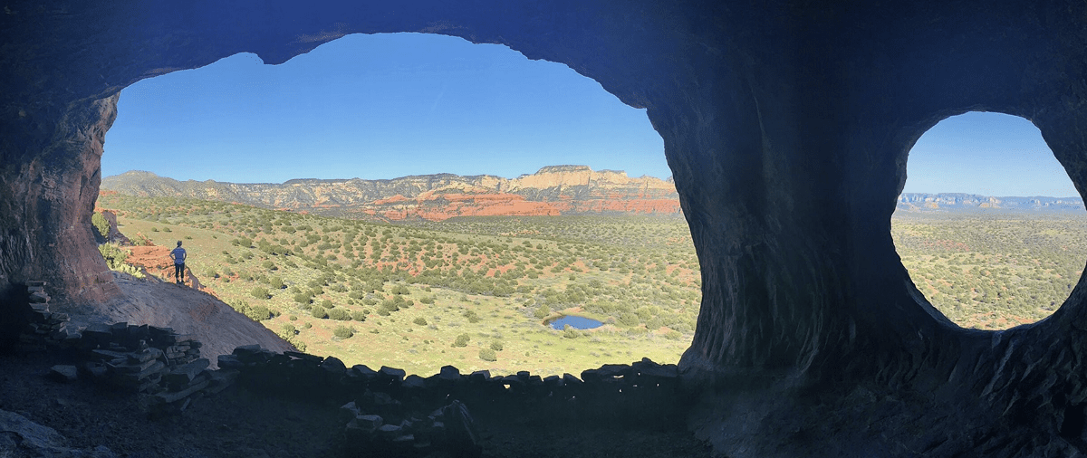
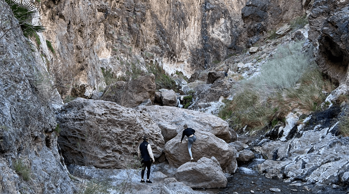
7. Ice Box Canyon Trail
The Ice Box Canyon Trail is a great way to experience the beauty of nature in Las Vegas, Nevada. This 2-mile trail takes you through a picturesque canyon that’s filled with lush vegetation and spectacular rock formations. The trailhead starts at the Red Rock Canyon National Conservation Area, where visitors can park their cars for easy access to the trail.
Once on the trail, hikers will be treated to stunning views of towering red sandstone cliffs and unique desert plants like yucca, cholla cactus and wildflowers. As you make your way down into the canyon, keep an eye out for wildlife such as lizards, jackrabbits and roadrunners. At certain points along the trail you may even catch glimpses of bighorn sheep or mule deer grazing among the rocks! As you reach deeper into Ice Box Canyon, it begins to narrow until eventually forming a slot canyon with sheer walls over 100 feet high! This is one of several slot canyons found in Red Rock Canyon making it popular among experienced hikers who are looking for more challenging terrain than what’s offered elsewhere in Las Vegas.
At its end point near Oak Creek Wash Road there are plenty of opportunities for photography so don’t forget your camera! Once done exploring this incredible place don’t miss out on other trails nearby such as La Madre Spring Loop Trail or Calico Basin Trail—both located within Red Rock Canyon National Conservation Area.
8. Petroglyph Trail
The Petroglyph Trail in Las Vegas is a great way to explore the beauty of Nevada. The trail is located on Red Rock Canyon National Conservation Area, which offers some incredible views of the surrounding desert landscape. This area was once home to ancient cultures that left behind petroglyphs, or rock carvings and paintings, for us to enjoy today.
The hike along the Petroglyph Trail begins at an elevation of about 4200 feet and winds through a series of canyons before eventually reaching a peak at 5500 feet. Along the way hikers will have plenty of opportunity to admire some amazing petroglyphs that were created by native tribes thousands of years ago. In addition to these ancient works, there are also numerous other sights worth exploring such as sandstone formations and stunning vistas.
For those who want more than just sightseeing, there are plenty of opportunities for wildlife viewing and even rock climbing if you’re feeling adventurous! It should be noted though that this particular trail is not suitable for inexperienced climbers due its steep slopes and rocky terrain so it’s best suited for experienced adventurers only. Overall, the Petroglyph Trail in Las Vegas provides an excellent opportunity to explore both nature and culture all in one go!
Elevation: 500 feet | Distance: 4.4 miles | Difficulty: Moderate
9. Gold Strike Canyon Trail
The Gold Strike Canyon Trail is a great way to explore the beauty of the Las Vegas area. Located in Lake Mead National Recreation Area, this trail offers stunning views of the majestic red rock formations and desert landscapes surrounding Las Vegas. The trail itself is relatively easy, with an elevation gain of only about 500 feet over its 2.5 mile length making it suitable for all skill levels.
The beginning of the hike starts at a parking lot near Hemenway Harbor on Lake Mead where you will find restrooms and drinking fountains as well as plenty of shade from nearby trees. As you start out on your journey, keep your eyes open for lizards darting across the sandstone rocks that line much of this path. Along with beautiful wildflowers blooming during certain times of year, cacti can also be found scattered throughout the landscape providing an interesting contrast against their surroundings.
As you make your way further along into Gold Strike Canyon Trail, stunning views await around every corner! From high cliffs overlooking Lake Mohave to deep drop-offs that give off incredible panoramic views towards Hoover Dam and beyond – there’s no shortage of breathtaking scenery here! Additionally, visitors may get lucky enough to spot some wildlife such as bighorn sheep or other animals taking refuge in these secluded areas away from human development. At the end point stands a large sign indicating “Goldstrike Mine” which marks what was once an active gold mine located in this part of Nevada back in 1906 before being abandoned shortly after due to low yields and difficult working conditions. While nothing remains today except for some old mining equipment scattered around – it still makes for a fascinating reminder when exploring this otherwise peaceful canyon trail!
Distance: 6 miles | Difficulty: Difficult
10. Wetlands Park Nature Preserve
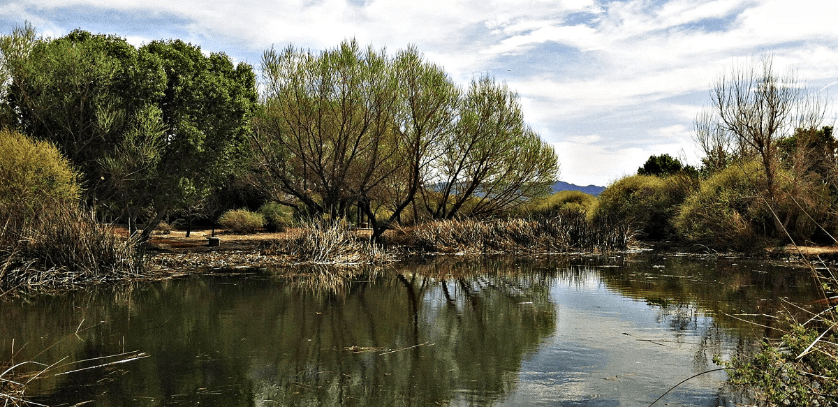
The Wetlands Park Nature Preserve is a unique and beautiful natural area in Las Vegas, Nevada. Located just five miles from the famous Las Vegas Strip, this vast expanse of wetlands provides an escape from the hustle and bustle of city life. Visitors to Wetlands Park can explore more than three miles of trails that wind through diverse habitats such as riparian woodlands, seasonal ponds, marshes and meadows. These trails offer amazing opportunities for wildlife viewing; birds such as ducks, geese and herons are often seen along with other wildlife including rabbits, coyotes and even bobcats.
In addition to the spectacular nature views on display at Wetlands Park Nature Preserve trail there are also several educational programs available to visitors who wish to learn more about wetland ecology or local species. The park offers guided hikes lead by knowledgeable staff members who will be happy to provide information on plants and animals found in the area. There are also interpretive signs along some sections of trail that provide additional insight into the natural world around you. Wetlands Park Nature Preserve trail is open year-round during daylight hours so visitors can enjoy its beauty any time they’re in town.
Elevation: 26 feet | Distance: As long as 7 miles with many loop trails | Difficulty: Easy
11. Calico Tanks Trail
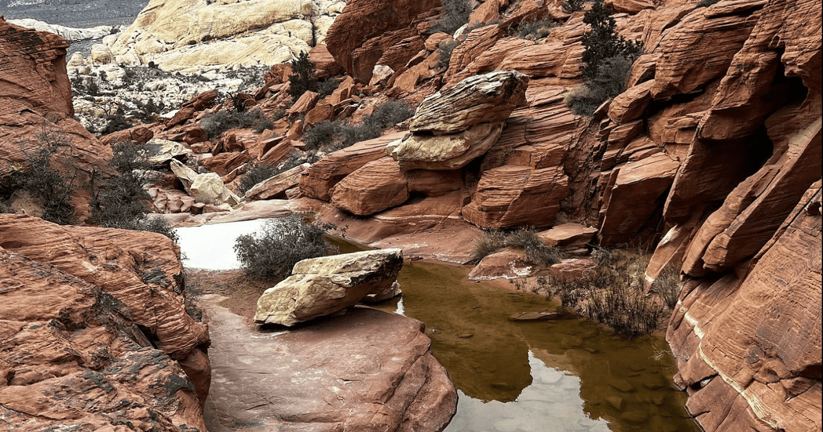
Calico Tanks Trail is a popular hiking trail located in Las Vegas, Nevada. The trail is approximately 2.5 miles long and features stunning views of the desert landscape as well as wildlife sightings. At the end of the hike, visitors will find themselves at Calico Tanks, a natural water storage tank carved into solid rock by ancient native peoples. This area was once used for spiritual ceremonies and remains an important part of local history today.
The Calico Tanks Trail itself follows an easy to moderate path with some steep inclines along the way that can be challenging. Along the route hikers will encounter sandstone formations, slot canyons, and lush vegetation like yucca plants and Joshua trees growing on either side of them – all providing ample opportunities for unique photo opportunities or just simply taking in the scenery around you! At certain points during your journey up to Calico Tanks you’ll have spectacular views overlooking Red Rock Canyon National Conservation Area – one of most beautiful places near Las Vegas!
This incredible trail also offers plenty of educational opportunities about both nature and Native American culture due to its close proximity to Red Rock Canyon NCA’s visitor center where rangers are available to answer any questions hikers may have while exploring this area’s rich history. Whether you’re looking for a light stroll or want something more strenuous with rewarding panoramic vistas at every turn, Calico Tanks Trail has something for everyone!
Difficulty: Moderate | Distance: 2.2 miles round trip
12. First Creek Canyon Trail
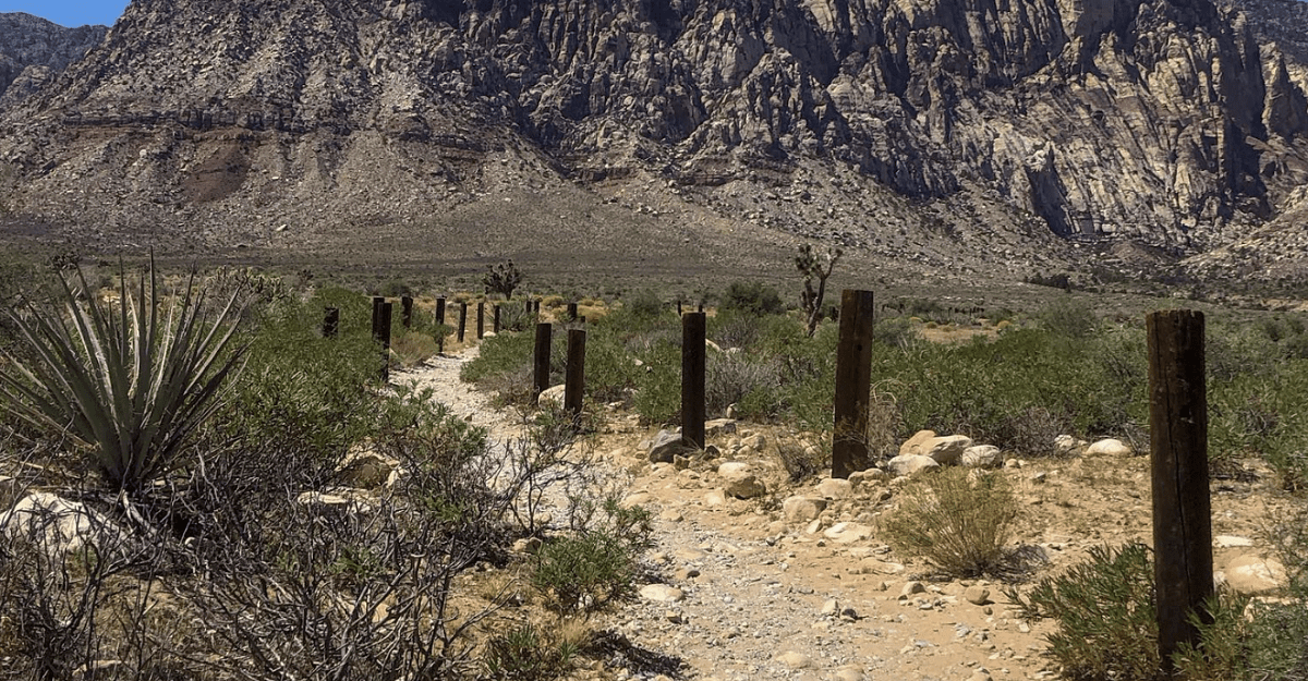
First Creek Canyon Trail is a popular hiking trail located in the Las Vegas area. The trail winds through beautiful canyons and offers stunning views of the Red Rock National Conservation Area. This moderately-difficult hike is approximately 6 miles long round trip, with an elevation gain of 500 feet. The trails starts near the base of Calico Basin and follows First Creek upstream before reaching its peak at the top of Sunrise Mountain.
Along the way, hikers will find plenty to explore including rock formations, sandstone cliffs, desert wildflowers and wildlife such as lizards, snakes and birds. There are also several side trails that offer additional exploration opportunities for those who want more adventure or solitude away from other hikers. At the end of this trail lies a special treat: an oasis at Ice Box Canyon where you can take a break by soaking your feet in cool waters surrounded by lush vegetation! This spot provides much needed respite from hot summer temperatures in Las Vegas Valley – making it perfect for a picnic lunch or just taking some time out to relax and enjoy nature’s beauty.
Overall, First Creek Canyon Trail is one of the best hikes around Las Vegas due to its variety of terrain and spectacular views along with its easy access via nearby highways 95/215 interchange off Sahara Avenue (westbound). Whether you’re looking for an easy day hike or something more challenging, this trail has something to offer everyone – making it well worth exploring!
Difficulty: Moderate | Distance: 4 miles
13. Mary Jane Falls
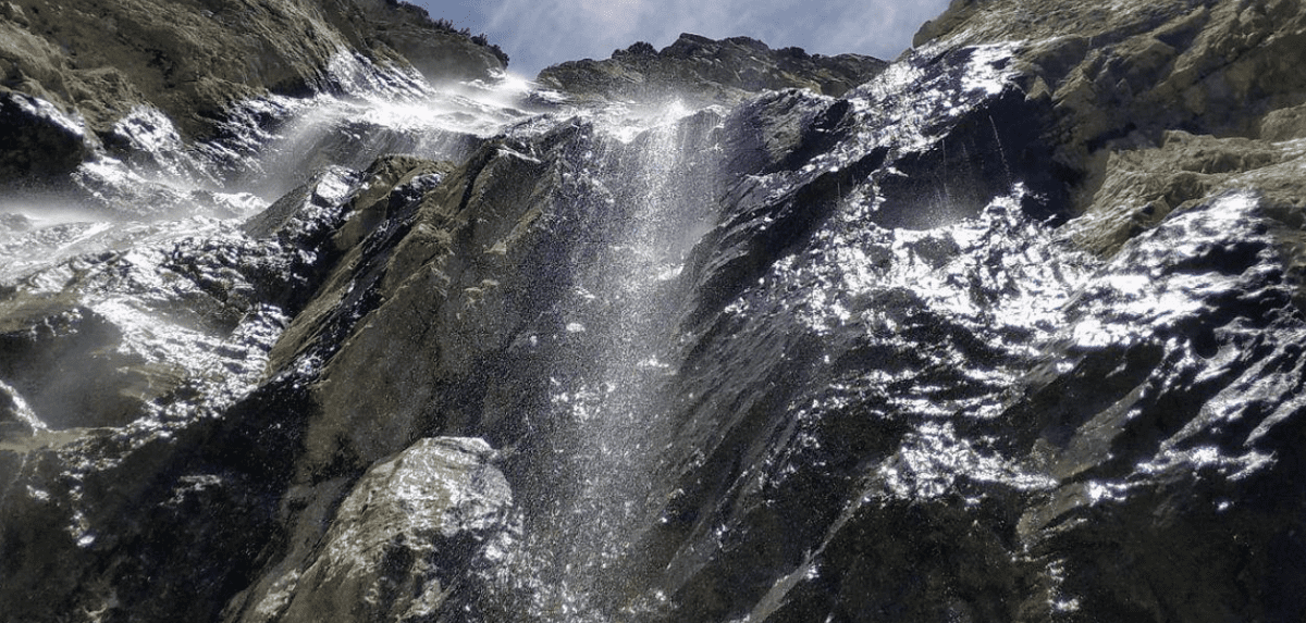
The Mary Jane Falls Trail is a popular hiking trail located in the Las Vegas Valley. This scenic hike offers stunning views of the surrounding mountains, as well as a unique experience to explore nature. The trailhead is easily accessible from both Summerlin and Red Rock Canyon National Conservation Area.
The beginning of the trail starts off easy with a gradual incline that leads you through some juniper trees and other plants native to the area. As you make your way up, you will pass by rock formations and enjoy several viewpoints along the way. Once at the top, hikers are greeted with spectacular views of nearby peaks and canyons before descending down into an alpine meadow where they can find Mary Jane Falls cascading down over rocks into a small pond below. In addition to taking in these amazing sights, visitors can also take advantage of numerous activities available along this path such as bird watching, picnic spots or just relaxing in nature’s embrace for awhile.
Hikers should be sure to wear proper shoes for their journey since parts of this trek involve climbing over boulders or loose gravel patches throughout its course – but don’t worry; it’s all worth it when you reach those beautiful falls!
Elevation: 980 feet | Distance: 2.9 miles | Difficulty: Moderate
 Hiking in Georgia