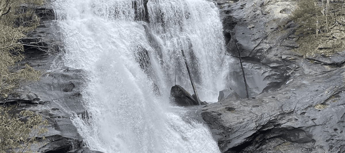
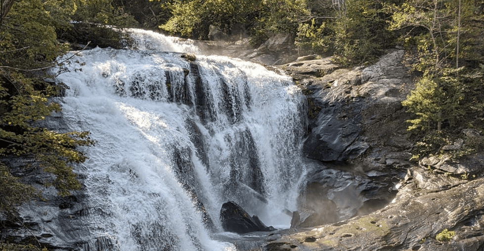
Bald River Falls is a stunning waterfall located in Cherokee National Forest near Tellico Plains, Tennessee. This majestic cascade drops an impressive 90 feet over a wide ledge and into the Bald River Gorge below. The falls are surrounded by thick forests of oak, hickory and hemlock trees, creating the perfect setting for a day of exploration.
Details about Bald River Falls
The best view of Bald River Falls can be found from the overlook at the end of the short trail that leads up to it. From here you can take in all its beauty as well as get some great photos with your phone. There are also a several picnic areas nearby where visitors can rest after their hike or just take in the scenery while enjoying lunch with family and friends.
There are plenty of activities in the area around Bald River Falls such as swimming (in designated areas), fishing, rafting, kayaking and tubing down the river below the falls. Hiking trails seem to be everywhere throughout Cherokee National Forest so you’ll never run out of things to do!
Directions to Bald River Falls
Address: Elizabethton, TN 37312
To get there from Knoxville: Map
Take US-411 North for about 50 miles until you reach Tellico Plains. Turn right onto TN-165 and follow it for 6 miles until you see Bald River Road/Forest Road 210 on your left. Take this road for 4 miles until you arrive at a parking area just before a bridge crossing over Bald River.
From here, there is an easy 0.3 mile hike along the river to reach the falls. Be sure to bring plenty of water and snacks as well as insect repellent if needed!
Hiking Trails near Bald River Falls
The Benton MacKaye Trail is one of the most popular hikes in Cherokee National Forest. This 300-mile trail stretches across the entire length of the national forest and passes through some beautiful landscapes such as mountain ridges, valleys, creeks and streams. It also takes hikers along many historical sites like old homesteads and Civil War battlefields.
Big Creek Trail near Ocoee Whitewater Center. This 6-mile loop features stunning views along with plenty of wildlife sightings as you venture through lush forests and rugged terrain.
Hangover Lead Trail which winds its way up Unaka Mountain at 4500 feet above sea level before descending back down into Tellico Plains area after 18 miles roundtrip journey! Along this hike you will experience incredible vistas while passing by cascading waterfalls throughout your trekking route.
Chestnut Top Loop located near Chilhowee Recreation Area which provides 8 miles worth of peaceful tranquility amid towering hardwood trees & wildflower blooms during Springtime months.
 Ozone Falls